Documenting North America's past & present covered bridges


Home

Campbell, Greenville County

If you find errors in the data please contact Bill Caswell.

If you would like to provide information on covered bridges that no longer exist from your state, or adopt a state to work on, we would certainly welcome your assistance. Please contact Trish Kane for more information.

Inventory Number: SC/40-23-02
County: Greenville County
Township:
Town/Village: Gowensville
Bridge Name: Campbell
Crosses: Beaverdam Creek
Truss type: Howe with Counterbraces
Spans: 1
Length: 41'
Roadway Width:
Built: 1909
Builder: Charles Irwin Willis
When Lost: standing
Cause:
Latitude: N35 05.145
Longitude: W082 15.848
See a map of the area
Topographic map of the area
Directions: 1.1 miles west of jct SC14 on SC414, then 0.4 miles left on Pleasant Hill Rd. (TR414) and 0.1 miles right on bypassed section of Campbell Covered Bridge Rd.

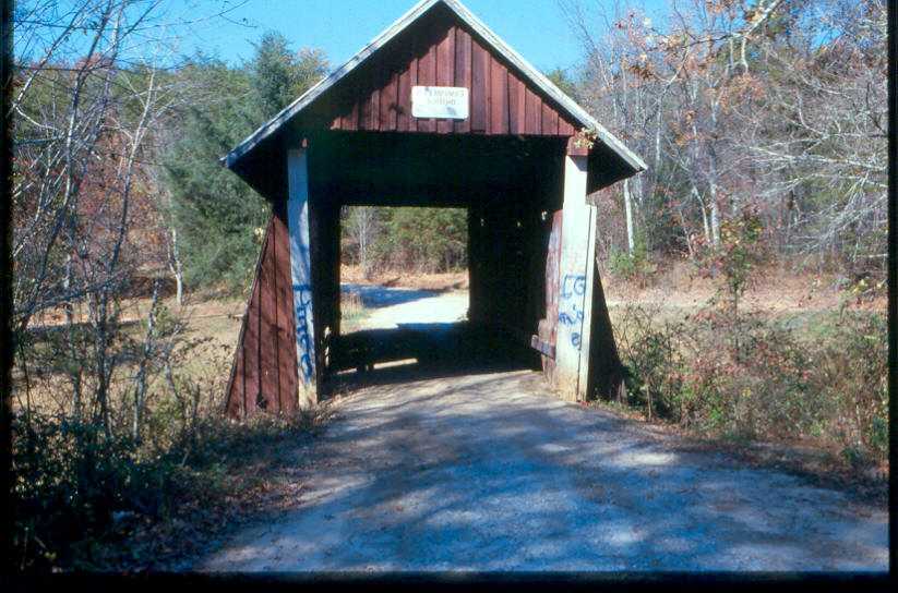
Campbell Bridge, Gowensville, Greenville County, SC Built 1909
Richard Donovan / Trish Kane Collection
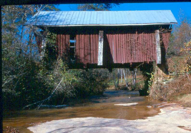

Campbell Bridge, Gowensville, Greenville County, SC Built 1909
Richard Donovan / Trish Kane Collection


Campbell Bridge, Gowensville, Greenville County, SC Built 1909
Bill Caswell Photo, July 25, 2008

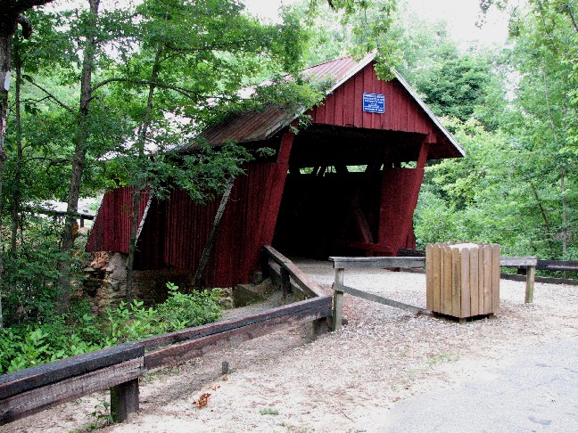
Campbell Bridge, Gowensville, Greenville County, SC Built 1909
Bill Caswell Photo, July 25, 2008
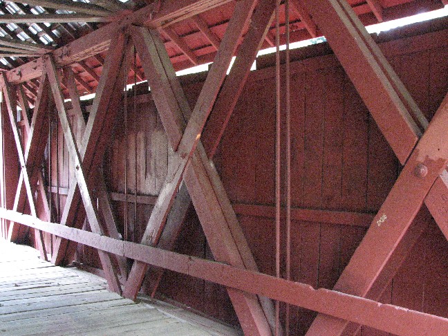

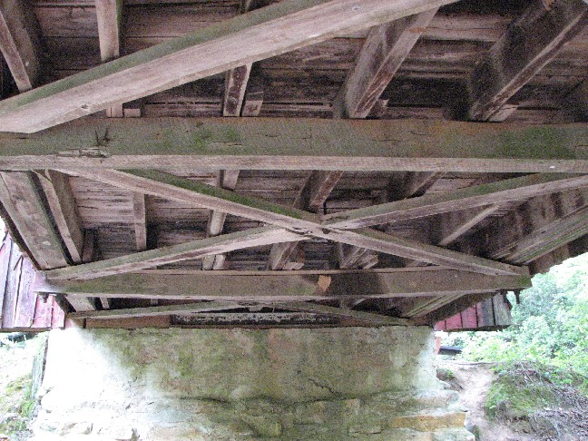
Campbell Bridge, Gowensville, Greenville County, SC Built 1909
Bill Caswell Photo, July 25, 2008
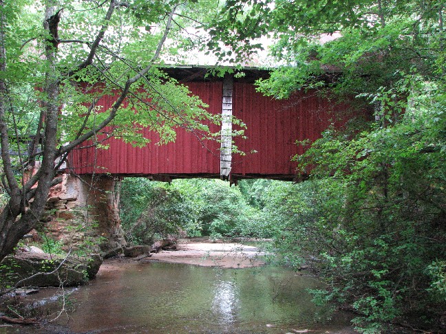

Campbell Bridge, Gowensville, Greenville County, SC Built 1909
Bill Caswell Photo, July 25, 2008

Comments:
Campbell’s Bridge was built in 1909 on Campbell Covered Bridge Road. Charles Irwin Willis (1878-1966), an accomplished local builder in the northern part of Greenville County, built the bridge in 1909. Long and large timbers required for the bridge exceeded the capability of most sawmills, and had to be sawed by a nearby sawmill owned and operated by James M. Suddeth. When completed, the bridge was named for Alexander Lafayette Campbell (1836-1920), local landowner and millwright who lived at the site and operated a corn grist mill about 50 feet downstream from the bridge. This wooden bridge with a metal roof is 35’ long by 12’ wide. It sits on a rock foundation with a concrete cap, as masons supplemented existing rock formations on each side of Beaver Dam creek as load-bearing abutments and partial foundations. Concrete was poured atop the rock formations, and 12” x 12” heart-of-pine sills were mounted on the concrete cap with 4.5” iron rods. Once the two trusses were in final position, they were braced or tied in place for the remaining construction of the bridge decking, sides and roof. Buttresses were then built at each end of the bridge and at the center point of each truss. They rested on the main timbers carrying the floor load and extended three feet past the sides of the bridge to provide stability along the weak axis of the truss. Willis allowed the truss ends to follow the natural lay of the land and built the rest of the bridge to fit; as a result—and according to Willis’s design—the bridge is neither square nor plumb. In 1951, Pleasant Hill Road was rerouted, and the historic roadbed was renamed Campbell Covered Bridge Road. It remained a gravel-over-clay road until it was resurfaced by tar and gravel in 1987. In 1964, the bridge siding, deck, and roof were repaired and the bridge was painted, most likely for the first time. In 1984, Greenville County closed the bridge to all vehicular traffic. By 1990, the bridge needed renovation once more; worn or rotted boards were replaced with fresh rough-cut pine boards and the tin roof was replaced with a galvanized steel roof. The land surrounding the bridge was owned by Sylvia Pittman until 2005, when she sold 10 acres to Greenville County for a park around the bridge. The bridge was added to the National Register of Historic Places on July 1, 2009.
Sources:
National Register of Historic Places Registration Form.
Rogers, Howard. Notebook of North & South Carolina Covered Bridges, 2005
National Society for the Preservation of Covered Bridges. World Guide to Covered Bridges, 2021, page 135

Compilation © 2024 Covered Spans of Yesteryear

The images in this collection may be protected under copyright law and may only be used for educational, teaching, and research purposes.
If the intended use is beyond these purposes, it is the responsibility of the user to obtain the appropriate permissions from the owner stated in the image's credits.


Home | Copyright Notice | Reports | Credits | Unidentified Bridges | FAQ | Links

www.lostbridges.org