| Inventory Number: | PA/38-56-03 | | County: | Somerset County | | Township: | Middle Creek | | Town/Village: | Barronvale | | Bridge Name: | Barronvale | | Crosses: | Laurel Hill Creek | | Truss type: | Multiple King & Tied Arch | | Spans: | 2 | | Length: | 162' | | Roadway Width: | 13'-10" | | Built: | 1902 | | Builder: | Cassimer Cramer | | When Lost: | standing | | Cause: | | | Latitude: | N39 57.165 | | Longitude: | W079 16.229 | | See a map of the area
Topographic map of the area | | Directions: | 2.0 miles west of jct PA281 on PA653, then 1.0 miles right on Ream Rd. (SR3035), and 320 feet right and and 140 feet straight ahead on a bypassed section of Ream Rd. Northwest of New Lexington. |
|
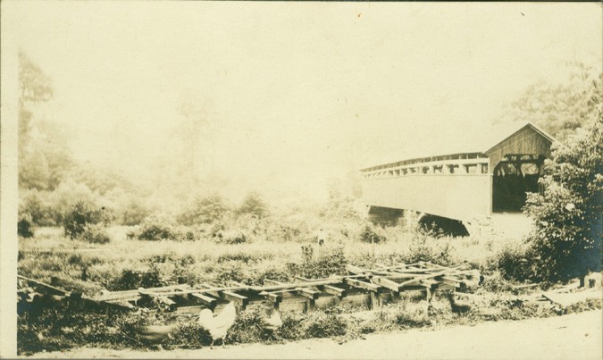
Barronvale Bridge, Middle Creek, Somerset County, PA. Built 1830 or 1902
Todd Clark Collection 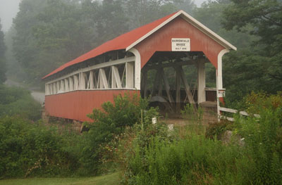
Barronvale Bridge, Middle Creek, PA. Built 1902
© Lisa Plamondon
Barronvale Bridge, Middle Creek, Somerset County, PA. Built 1902
Bill Caswell Photo, February 27, 2010
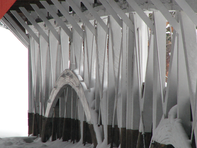
Barronvale Bridge, Middle Creek, Somerset County, PA. Built 1902
Bill Caswell Photo, February 27, 2010
|
Sources:
Evans, Benjamin D. & June R.. Pennsylvania's Covered Bridges, 2001, page 242
Barkman, Sheldon H.. Covered Bridges of Somerset County, PA, 1979, Page 8
National Society For the Preservation of Covered Bridges. Covered Bridge Topics, Volume XLVIII, No. 2, Spring 1990, page 10
Moll, Fred J.. Pennsylvania's Covered Bridges - Our Heritage, 2004, pages 128-129
Kipphorn, Thomas. Information received by email, May 2012
National Society for the Preservation of Covered Bridges. World Guide to Covered Bridges, 2021, page 128 |