Documenting North America's past & present covered bridges


Home

Lower Ferry or Gray's Ferry or Matthew Newkirk's Viaduct, Philadelphia County

If you find errors in the data please contact Bill Caswell.

If you would like to provide information on covered bridges that no longer exist from your state, or adopt a state to work on, we would certainly welcome your assistance. Please contact Trish Kane for more information.

Inventory Number: PA/38-51-04x
County: Philadelphia County
Township: Philadelphia
Town/Village:
Bridge Name: Lower Ferry or Gray's Ferry or Matthew Newkirk's Viaduct
Crosses: Schuylkill River
Truss type: Town / Howe
Spans: 6
Length: 800'
Roadway Width:
Built: 1838
Builder:
When Lost: 1898
Cause: Replaced
Latitude: N39 56.45
Longitude: W075 12.33
See a map of the area
Topographic map of the area
Directions: On Gray's Ferry Road (SR3021 - LR67309).

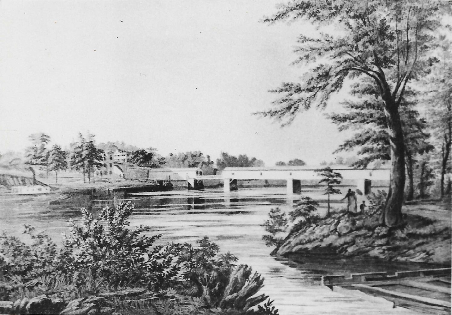
Lower Ferry or Gray's Ferry or Matthew Newkirk's Viaduct Bridge, Philadelphia, Philadelphia County, PA Built 1838 Replaced 1898
Richard Sanders Allen Collection, NSPCB Archives
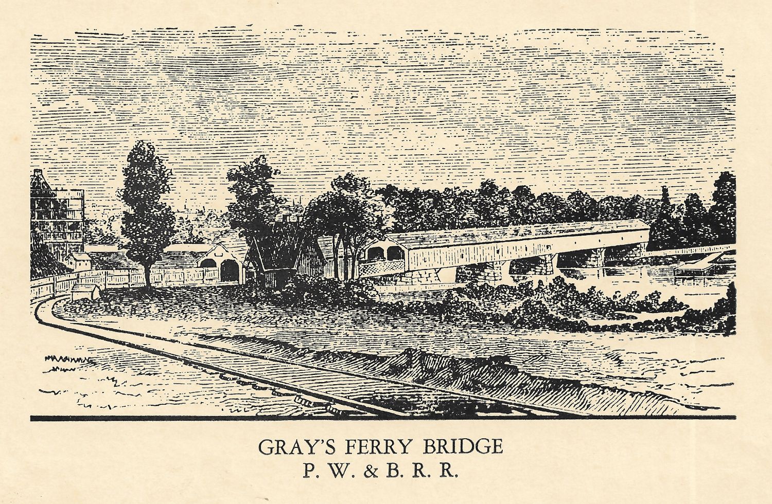

Lower Ferry or Gray's Ferry or Matthew Newkirk's Viaduct Bridge, Philadelphia, Philadelphia County, PA Built 1838 Replaced 1898
Richard Sanders Allen Collection, NSPCB Archives


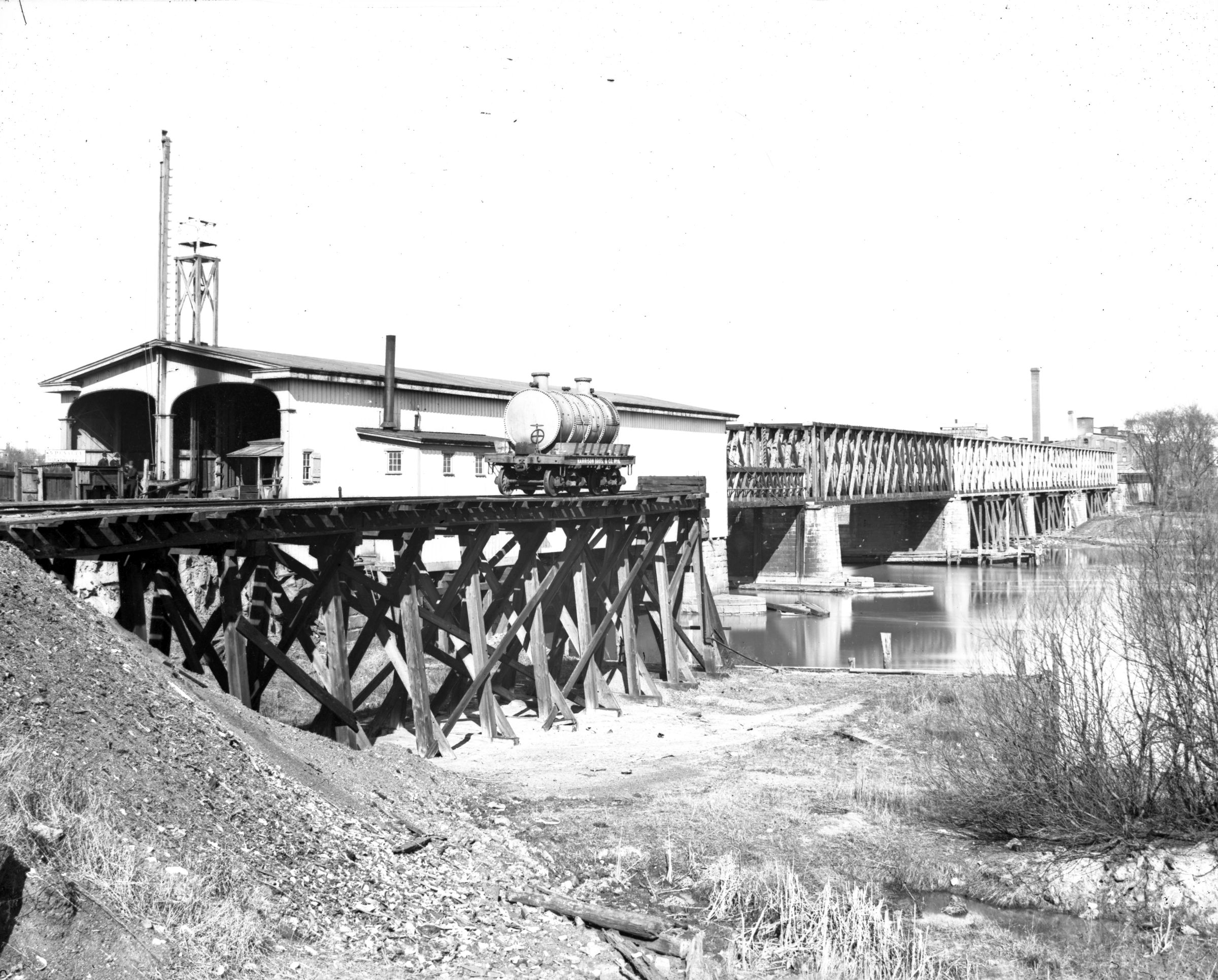
Lower Ferry or Gray's Ferry or Matthew Newkirk's Viaduct Bridge, Philadelphia, Philadelphia County, PA Built 1838 Replaced 1898
Glass Plate Negative (1895) in Mac McClaren Collection

Comments:
12-panel truss. The first bridge at the site was a "floating bridge" of logs, built by the British in 1778, during their occupation of Philadelphia. It had large hinges so that it could rise and fall with the tides and was kept in position by chains and anchored at its shore ends. The central part was moveable to allow for passage of ships. Across this bridge in 1789, General George Washington passed, on his way to New York, to be inaugurated as the Nations First President. There was a Town Lattice Truss structure of six spans and length of 800' built in 1838 by the Philadelphia, Wilmington, and Baltimore Railroad, which was later absorbed by the Pennsylvania Railroad. Whether the floating bridge stood until 1838, or there was some other bridge between the two is unknown. The 1838 bridge was a through-truss double barrel, with the south lane for railroad traffic and the other for carriages. The 5th span from the east was designed to telescope into the 6th span, allowing river traffic to pass. In 1863, all but the westernmost span were destroyed by fire. The five burned spans were replaced by 4 12-panel Howe through spans and a pony truss lift section that were left uncovered until replaced in 1898. When comparing different-aged maps, the current bridge is at, or very close to the original site, but the railroad no longer crosses at this location. Al Giannantonio, President of the Philadelphia Chapter of The Pennsylvania Railroad Technical & Historical Society provided information from the Maryland Division Bridge List of 1889 which shows what appears to be 4 spans with a total length of 503'-4". One of those spans was a Howe Truss bridge with a covered length of 144' and 92' span. This may have been a replacement for the Town truss bridge described earlier.
Sources:
Moll, Fred J.. Pennsylvania's Covered Bridges - Our Heritage, 2004, pages 122-123
Kipphorn, Thomas. Information received by email, March 2007

Compilation © 2024 Covered Spans of Yesteryear

The images in this collection may be protected under copyright law and may only be used for educational, teaching, and research purposes.
If the intended use is beyond these purposes, it is the responsibility of the user to obtain the appropriate permissions from the owner stated in the image's credits.


Home | Copyright Notice | Reports | Credits | Unidentified Bridges | FAQ | Links

www.lostbridges.org