| Inventory Number: | PA/38-36-10 | | County: | Lancaster County | | Township: | Brecknock - East Earl | | Town/Village: | | | Bridge Name: | Oberholtzers Mill or Red Run | | Crosses: | dry land | | Truss type: | Burr | | Spans: | 1 | | Length: | 107' span, 119' overall | | Roadway Width: | 12' | | Built: | 1866 | | Builder: | Elias McMellen | | When Lost: | standing | | Cause: | | | Latitude: | N40 10.517 | | Longitude: | W076 04.872 | | See a map of the area
Topographic map of the area | | Directions: | 3.8 miles northeast of jct US322 on PA272, then 1.9 miles right on W Church St. (SR1051) (becomes E Church St.) and 1.9 miles left on left side of Red Run Rd. (SR1044) in Red Run Campground. Southeast of Reamstown, 0.5 miles south of Red Run. |
|
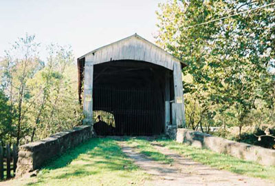
Oberholtzers Mill or Red Run Bridge, Brecknock, Lancaster County, PA. Built 1866
Bill Caswell Photo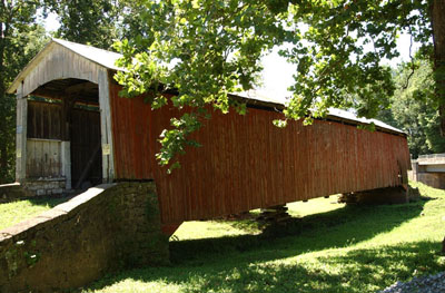
Oberholtzers Mill or Red Run Bridge, Brecknock, Lancaster County, PA. Built 1866
© Lisa Plamondon
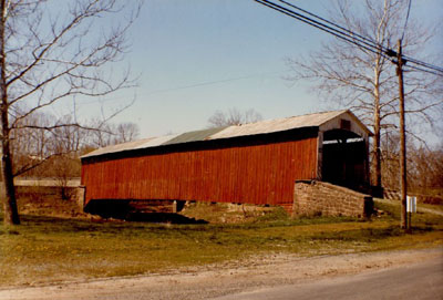
Oberholtzers Mill or Red Run Bridge, Brecknock, Lancaster County, PA. Built 1866
Thomas G. Kipphorn Collection
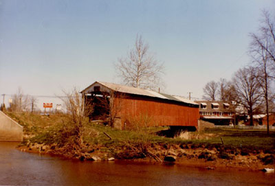
Oberholtzers Mill or Red Run Bridge, Brecknock, Lancaster County, PA. Built 1866
Thomas G. Kipphorn Collection
|
Sources:
Evans, Benjamin D. & June R.. Pennsylvania's Covered Bridges, 2001, page 178
Travis, Dale. Pennsylvania Covered Bridges List, updated to 26 Aug 2004, http://www.dalejtravis.com/cblist/cbpa.htm (23 Sep 2004)
Collins, Kenneth W.. Covered Bridges of Lancaster County, Pennsylvania, 2002, pages 68-69
Moll, Fred J.. Pennsylvania's Covered Bridges - Our Heritage, 2004, pages 108-109
Kipphorn, Thomas. Information received by email, September 2005
National Society for the Preservation of Covered Bridges. World Guide to Covered Bridges, 2021, page 117 |