| Inventory Number: | NH/29-04-P02 | | County: | Coös County | | Township: | Randolph | | Town/Village: | | | Bridge Name: | Snyder Brook | | Crosses: | Snyder Brook | | Truss type: | Boxed Pony Howe | | Spans: | 1 | | Length: | 41' or 35'-10" | | Roadway Width: | 15' 4" | | Built: | 1918 | | Builder: | Boston & Maine Railroad | | When Lost: | standing | | Cause: | | | Latitude: | N44 22.274 | | Longitude: | W071 17.112 | | See a map of the area
Topographic map of the area | | Directions: | 5.4 miles west of jct NH16 on US2 to National Forest Parking Area. Walk 0.2 miles east on old Boston & Maine Railroad grade. | | Comments: | Boston & Maine Railroad #254 at milepost 143.06 . |
|
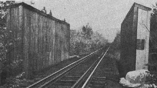
Snyder Brook Bridge, Coös County, Randolph, NH. Built 1918
Richard E. Roy Collection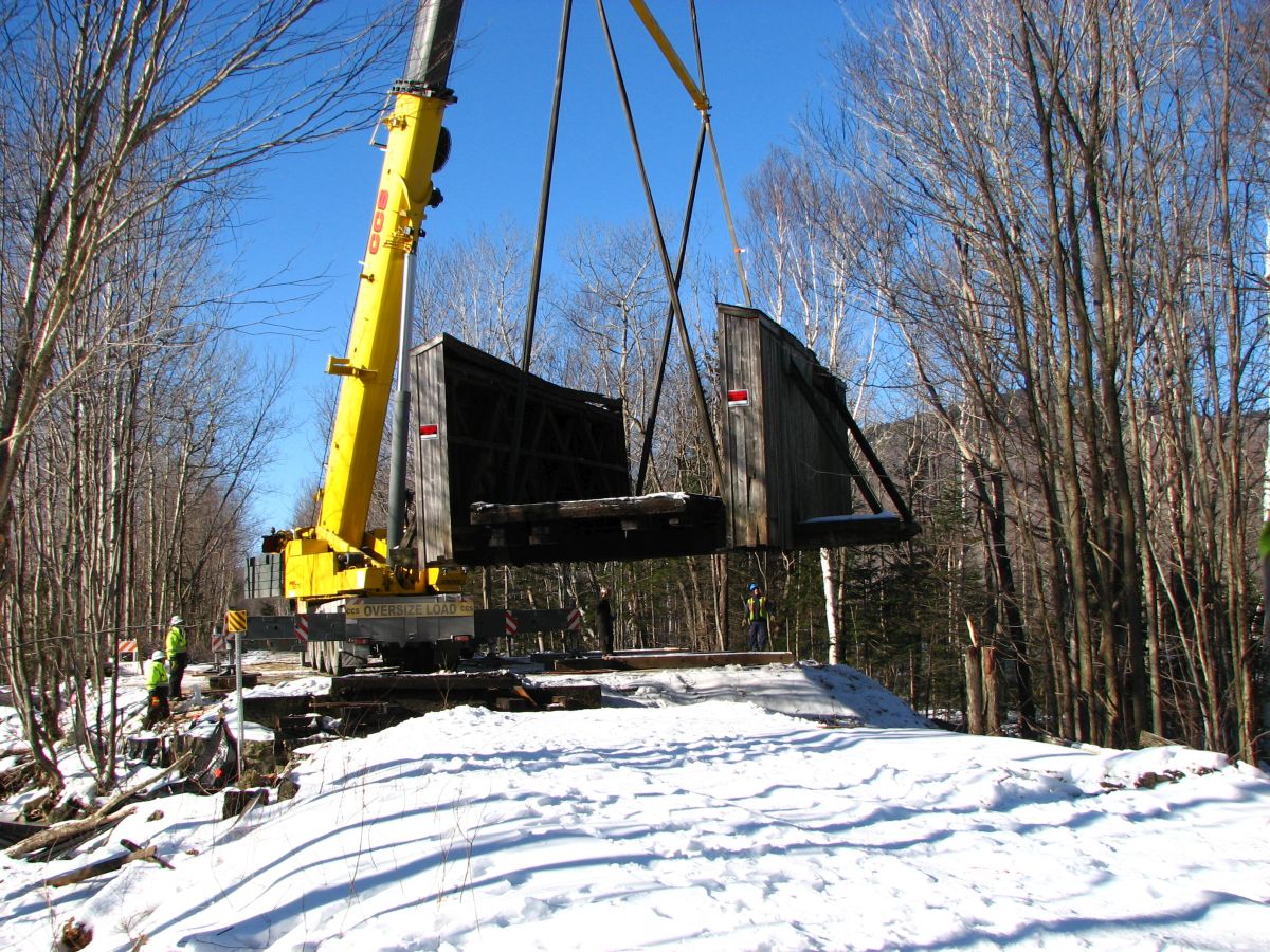
Snyder Brook Bridge, Randolph, NH, being moved for abutment repairs.
Bill Caswell Photo, December 5, 2014

Snyder Brook Bridge, Coös County, Randolph, NH. Built 1918
Bill Caswell Photo, June 23, 2014
|
Sources:
Connecticut River Valley Covered Bridge Society. Bulletin, Volume XV, No. 3, Winter 1969, page 8
National Society for the Preservation of Covered Bridges. World Guide to Covered Bridges, 2021, page 47
Chandler, Kim Varney. Covered Bridges of New Hampshire, 2022, Pages 246-248 |