Documenting North America's past & present covered bridges


Home

Northumberland-Sunbury (#1) or West Tandem, Northumberland County

If you find errors in the data please contact Bill Caswell.

If you would like to provide information on covered bridges that no longer exist from your state, or adopt a state to work on, we would certainly welcome your assistance. Please contact Trish Kane for more information.

Inventory Number: PA/38-49-45#2x
County: Northumberland County
Township:
Town/Village: Northumberland - Packers Island
Bridge Name: Northumberland-Sunbury (#1) or West Tandem
Crosses: North Branch Susquehanna River
Truss type: Burr
Spans: 4
Length: 848' 6"
Roadway Width:
Built: 1839
Builder:
When Lost: 09 Mar 1904
Cause: Flood
Latitude: N40 53.250
Longitude: W076 47.400
See a map of the area
Topographic map of the area
Directions: Route 14 (now Route 147) from Northumberland to Packers Island.

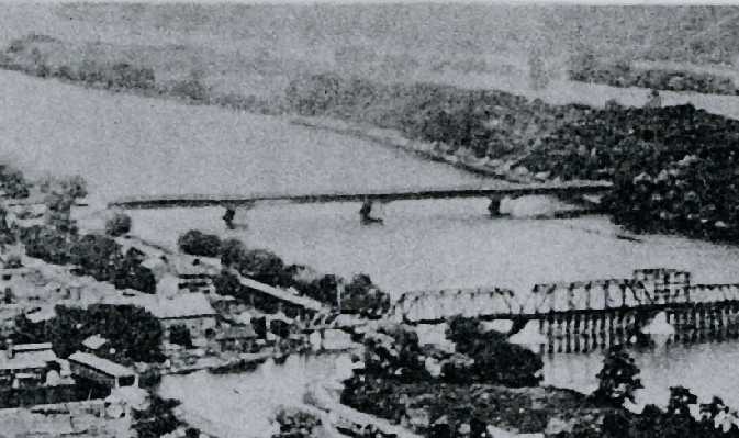
Northumberland-Sunbury (#1) or West Tandem Bridge, Northumberland-Packers Island, Northumberland County, PA. Built 1839 Flood 9 Mar 1904
Thomas G. Kipphorn Collection


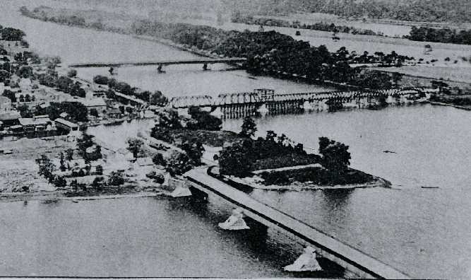
Northumberland-Sunbury or West Tandem Bridge (top), Sunbury and Erie West Tandem Railroad Bridge (middle), Blue Hill or Red Bridge (bottom), Canal Bridge (far left), Northumberland Boro, Northumberland County, PA
Thomas G. Kipphorn Collection

Comments:
The first bridge at the site was started by Theodore Burr in 1812 and finished in 1813. It was four spans with a length of 848'6". It has been documented as the first bridge to cross the Susquehanna, or its branches. It was of humpback Burr Arch Truss design and stood until washed away in 1839. Following a rebuilding within the same year, one span of the second bridge was washed away on March 17, 1875. Again, it was rebuilt within the same year and at this time it was changed to a level roadway, retaining the Burr design. After the entire bridge was washed away again on March 9, 1904, it was decided to replace it with a wrought iron truss bridge. There was about 1750' of roadway between the two bridges on Packers Island. The coordinates shown are at the center of the present bridge.
Source:
Kipphorn, Thomas. Information received by email, April 2006

Compilation © 2021 Covered Spans of Yesteryear


Home | Copyright Notice | Reports | Credits | Unidentified Bridges | FAQ | Links

www.lostbridges.org