| Inventory Number: | MA/21-06-01 | | County: | Franklin County | | Township: | Conway | | Town/Village: | | | Bridge Name: | Burkeville or Conway | | Crosses: | South River | | Truss type: | Howe | | Spans: | 1 | | Length: | 106' | | Roadway Width: | | | Built: | 1870 | | Builder: | | | When Lost: | standing | | Cause: | | | Latitude: | N42 30.470 | | Longitude: | W072 42.665 | | See a map of the area
Topographic map of the area | | Directions: | 6.3 miles northwest of jct I-91 on MA116 (Exit 25), then just left on Poland Rd. At Burkeville. |
|
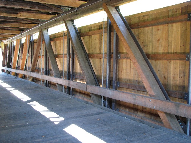
Burkeville Bridge, Conway, Franklin County, MA Built 1870
Bill Caswell Photo, September 2007
Burkeville Bridge, Conway, Franklin County, MA Built 1870
Bill Caswell Photo, September 2007
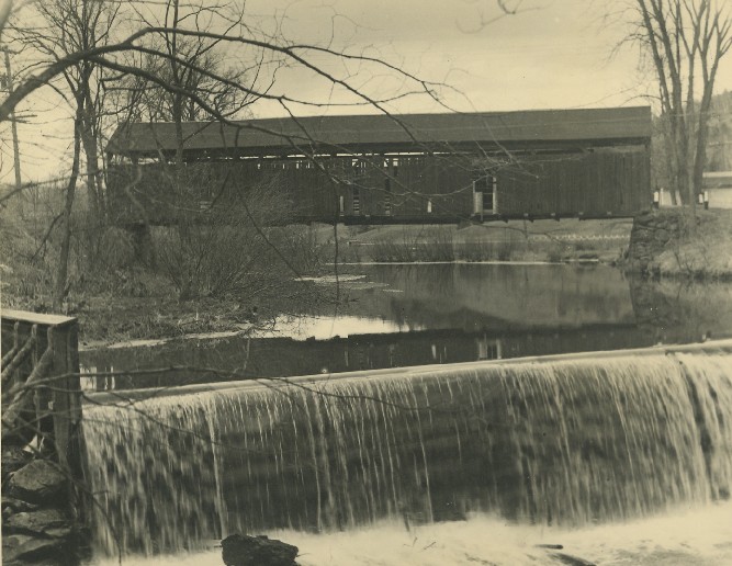
Burkeville Bridge, Conway, Franklin County, MA Built 1870
Richard E. Roy Collection
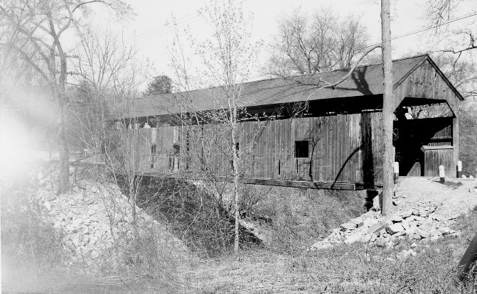
Burkeville Bridge, Conway, Franklin County, MA Built 1870
Richard E. Roy Collection
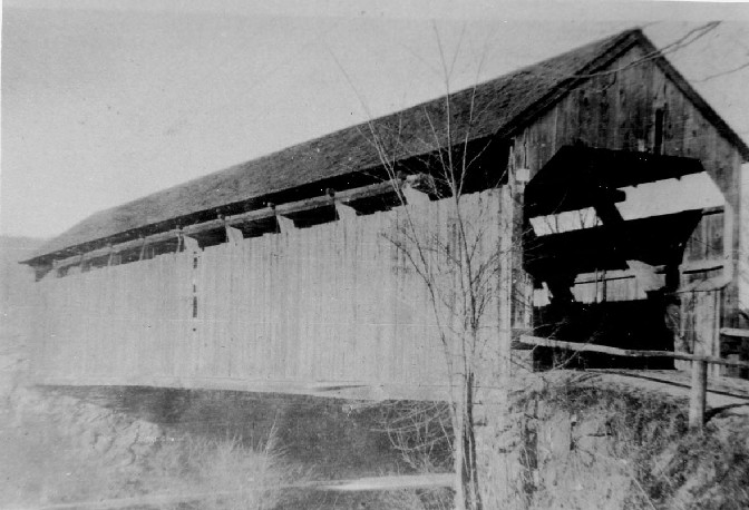
Burkeville Bridge, Conway, Franklin County, MA Built 1870
William Maxant Photo, April 30, 1939, Harvard (MA) Historical Society
|
Sources:
The Springfield Daily Republican of Thursday, November 9, 1939, page 10.
The Greenfield Recorder, November 13, 2013
Evans, Benjamin D. & June R.. New England's Covered Bridges, 2004, pages 67-68
Burk, John. Covered Bridges of Massachusetts, 2010, Pages 54-57
National Society for the Preservation of Covered Bridges. World Guide to Covered Bridges, 2021, page 39 |